Katahdin Woods and Waters is the least visited national monument in the Northeast — and one of the most spectacular. We’ve been watching it develop since its designation in 2016 and the wilderness character remains intact. The eastern view of Katahdin from within the monument is something very few people have seen.
Katahdin Woods and Waters National Monument is one of the newest and least visited national monuments in the United States — and one of the most spectacular. Established in 2016 and covering 87,500 acres of former commercial timberland in the heart of Maine’s North Woods, the monument protects a landscape of rivers, lakes, mountains, and boreal forest on the eastern edge of the Maine Highlands region. Mount Katahdin — the northern terminus of the Appalachian Trail and Maine’s highest peak — rises dramatically on the monument’s western boundary.
If you’ve been to Acadia National Park and thought “I wish this were less crowded,” Katahdin Woods and Waters is your answer.
What Is Katahdin Woods and Waters?
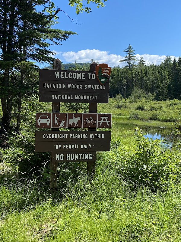
Katahdin Woods and Waters National Monument was designated by President Obama in August 2016, protecting 87,563 acres of land donated by Roxanne Quimby (founder of Burt’s Bees) and her family. The monument is managed by the National Park Service and is free to enter — there is no entrance fee. Infrastructure is still being developed, which means the experience is more rugged and self-directed than most national park units.
The Landscape
Rivers — The East Branch of the Penobscot River forms the western boundary, with dramatic gorges, waterfalls, and Class III-IV whitewater rapids. One of the finest wilderness paddling routes in the Northeast.
Mountains — The Katahdin Woods provide an eastern approach to the Katahdin massif, with views of Katahdin that few visitors ever see. The view from the eastern side — from within the monument — is arguably more dramatic than the views from Baxter State Park.
Ponds and lakes — Numerous remote ponds dot the monument’s interior, holding wild brook trout and supporting abundant wildlife. Many are accessible only by trail or logging road.
Boreal forest — A mix of recovering commercial timberland and older boreal forest providing habitat for moose, black bear, Canada lynx, fisher, and numerous boreal bird species.
Getting There
The most common approach is from Millinocket — approximately 2 hours from Bangor via I-95 and Route 11. Take Route 11 north to Patten, then head west on Shin Pond Road to the monument’s western access. Interior roads are unpaved logging roads — high-clearance vehicles are recommended. Cell service is essentially nonexistent — download offline maps before arriving.
What to Do
Drive the Loop Road — The monument’s 17-mile paved loop provides access to the main visitor areas, river overlooks, and trailheads. Suitable for all vehicles and the best introduction to the monument.
Hike the Monument Trails — Trails range from short nature walks to demanding summit climbs. The Haskell Rock Pitch Trail leads to a dramatic gorge overlook on the East Branch. Horse Mountain offers excellent views of Katahdin from the eastern side. Travelers Mountain delivers ridgeline views across the North Maine Woods.
Paddle the East Branch — One of the finest wilderness paddling rivers in Maine, with flatwater sections ideal for wildlife viewing and Class III-IV whitewater for serious paddlers. The full East Branch trip from Grand Lake Matagamon to Medway is a multi-day wilderness journey.
Fish the Remote Ponds — The monument’s interior ponds hold wild brook trout in largely unfished waters. A Maine fishing license is required. See our Maine fishing guide for license information.
Watch for Wildlife — Moose are abundant throughout the monument. Black bear, Canada lynx, bald eagles, and boreal bird specialties including black-backed woodpecker and gray jay are all present.
View Katahdin from the East — Multiple points within the monument offer views of Katahdin (5,267 feet) rising dramatically above the surrounding forest — a more remote and less visited perspective than Baxter State Park’s viewpoints.
Camping in the Monument
The monument has primitive camping areas along the loop road and at several interior locations. Camping is free and no reservations are required at most sites — a significant difference from the heavily booked Baxter State Park campgrounds nearby. Backcountry camping is permitted throughout with a free permit from the Visitor Contact Station or online. Bring everything you need — no hookups, no camp stores, no shower facilities.
Visiting with Baxter State Park
Katahdin Woods and Waters and Baxter State Park share the Katahdin massif — Baxter on the western side, the monument on the eastern side. Many visitors combine both in a single trip. Note that Baxter State Park has its own separate entrance fee and requires advance reservations for popular activities including the Katahdin summit trails.
Practical Tips
- Entrance fee: Free — no entrance fee for the monument
- Best season: June through October for most activities
- Bugs: Black flies are intense in May and June
- Water: No potable water available — bring all you need or treat surface water
- Gas: Fill up in Millinocket or Patten before entering
- Visitor Contact Station: Located in Patten on Route 159 — stop here for current road conditions and maps
Plan Your Trip
Ready to visit Katahdin Woods and Waters? Browse lodging in Millinocket — the closest gateway town with services. For more North Maine Woods exploration, see our Things to Do at Moosehead Lake guide, our Maine fishing guide, our Maine moose watching guide, and our Maine hiking guide.
About MaineGuide.com: MaineGuide.com has been helping visitors plan their Maine trips since 1995 — making us one of the longest-running and most comprehensive Maine travel resources on the web. Our guides are built on decades of firsthand Maine knowledge, local expertise, and a genuine love for the state.
📌 Exploring the North Maine Woods? Read our complete North Maine Woods Road Permit guide — checkpoints, fees, road conditions, and what to expect.