Gulf Hagas is a slate gorge on the West Branch of the Pleasant River in the Maine woods near Brownville, often called the Grand Canyon of Maine. A rim trail follows the gorge past a string of waterfalls. It is one of the best waterfall hikes in the state, but it is remote, the trip includes a long dirt-road drive and a river crossing, and it takes most of a day. This guide covers the loop options, how to get there, the fee, the crossing and what to bring.
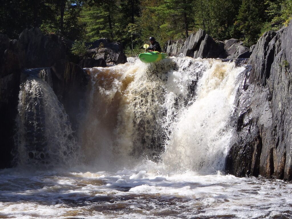
The details below come from Maine Trail Finder, Wikipedia and East Coast Hiker. They disagree on several numbers, especially fees and elevation gain, so where they differ we give the range. Fees, gate hours and conditions change, so check the official sources before you go, and see our North Maine Woods guide for how the checkpoint system works.
Gulf Hagas at a Glance
- Where: the Katahdin Iron Works area near Brownville and Monson, reached by a private logging road.
- The gorge: about 3 miles long. The river drops roughly 370 to 400 feet through it.
- Full loop: about 8 to 8.6 miles, using the Rim Trail and the Pleasant River Tote Road.
- Time: sources range widely. AllTrails says 3.5 to 4 hours of moving time, while Wikipedia and most guides say to allow 5 to 8 hours with stops. Plan on most of a day and don’t start late.
- Elevation gain: AllTrails lists 951 feet for the loop. Other sources estimate more, depending on the route.
- Difficulty: moderate. The trail has roots, rocks, mud and slippery slate ledges.
- Dogs: allowed, per Maine Trail Finder.
- Cell service: very unreliable to none.
Which Route to Hike
- The full Rim Trail loop (about 8 miles): follows the gorge past the major viewpoints and returns on the Pleasant River Tote Road. This is the classic hike.
- Screw Auger Falls (about 3.5 miles round trip): the shortest way to see a major waterfall here. The best choice if you want a shorter trip or arrive late in the day.
- Bridged crossing: the Head of the Gulf lot is on the road past the main lot and has a bridge, so you skip the river ford. See the crossing section below.
Billings Falls, about 20 feet high, is one of the highlights along the rim. The side paths to the viewpoints are steep, and the slate near the edges is slippery, so stay back from the drops.
How to Get to Gulf Hagas
Most visitors drive in on the Katahdin Iron Works Road, an unpaved private logging road. You pass through the KI Jo-Mary checkpoint, where the fee is collected. Tripadvisor reviewers describe more than 40 miles of dirt road in total, depending on where you start. Get current directions and a map at the checkpoint, from North Maine Woods, or from Maine Trail Finder.
Logging trucks use the road and have the right of way, so drive slowly, keep right and pull over for them. The road can be rough after rain.
Fees and Hours
The road crosses private land, and a day-use fee is collected at the checkpoint. The sources disagree on the amount. Maine Trail Finder lists $11 for Maine residents and $16 for non-residents, Wikipedia lists $11 and $22, East Coast Hiker lists $10 and $15, and a Tripadvisor reviewer reports $17 per person. Fees change, so treat these as a range, check before you go, and bring cash or a check.
Wikipedia says the gate is open from 6 a.m. to 9 p.m., and that the gatehouse operates May through October. Confirm the current schedule with North Maine Woods before you drive in.
The River Crossing
From the main Gulf Hagas parking area, the trail starts by fording the West Branch of the Pleasant River, roughly 100 to 150 feet wide. Maine Trail Finder says it is often knee-deep. East Coast Hiker says it is ankle-to-knee deep in summer, can be waist-deep in spring, and is lowest in late summer. Water shoes help, since the rocks are slippery, and a walking stick helps too.
Do not cross in high water, in spring or after heavy rain. The alternative is the Head of the Gulf lot, which has a bridge.
Safety and Rules
- Carry a map. Cell service is unreliable and this is a primitive area where help for lost or injured hikers is slow to arrive.
- Tell someone your plan, and bring food and water for the whole day.
- Watch the slate. Wet ledges near the viewpoints are slippery. Stay back from the edges.
- No camping or fires in the gorge. Pack out everything you bring.
- Swimming: none of the guides we checked lists it as an activity. The gorge is a fast river between steep walls, so treat any swimming as risky, especially after rain.
When to Go
The gatehouse runs May through October, and the water is lowest in late summer, which makes the crossing easier. Weekends are busy. Fall colors are popular too, but check the checkpoint schedule before a late-season trip.
More Waterfalls and Hikes
For more falls, see our best waterfalls in Maine and the easier Moxie Falls hike. For other trails, try our Maine hiking guide.
Frequently Asked Questions
How long is the Gulf Hagas hike?
The full Rim Trail loop is about 8 to 8.6 miles. Allow most of a day. Screw Auger Falls is a shorter option at about 3.5 miles round trip.
Is Gulf Hagas a hard hike?
It is moderate. The trail is rough, with roots, mud and slippery slate, and the day includes a river crossing and a long drive on dirt roads.
How much does it cost to hike Gulf Hagas?
There is no trail fee, but a day-use fee is collected at the checkpoint on the access road. Guides list $10 to $11 for Maine residents and $15 to $22 for non-residents. Check the current amount and bring cash or a check.
Do you have to cross a river to hike Gulf Hagas?
From the main parking area, yes. You ford the West Branch of the Pleasant River, usually knee-deep in summer. The Head of the Gulf lot has a bridge, which is the safer choice in high water.
Can you swim at Gulf Hagas?
The guides we checked don’t list swimming as an activity. The gorge has fast water and slippery slate, so treat swimming as risky.
Can you camp at Gulf Hagas?
No camping or fires are allowed in the gorge. Ask North Maine Woods about legal campsites in the surrounding area.
Can you take a dog to Gulf Hagas?
Yes, per Maine Trail Finder. Keep your dog under control near the ledges and on the river crossing.
Keep Reading
- North Maine Woods Road Permit: fees and checkpoints
- Best Waterfalls in Maine: falls worth a hike
- Moxie Falls: an easier waterfall hike
- Maine Hiking Guide: Acadia, Baxter and more