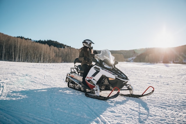
Buying Recreational Land on Maine’s ITS Snowmobile Trails — A practical guide. Updated June 2026. Trail access, power availability, the best regions, and what to verify before you buy.
For a certain kind of buyer, the dream is simple: a piece of Maine woods where you can start the sled at your own door and ride onto the Interconnected Trail System — with power at the camp so it’s a real basecamp, not a rough off-grid outpost. That combination — trail-accessible recreational land with power — is one of the most sought-after and misunderstood niches in the Maine land market. This guide explains how to find it, what the listings don’t tell you, and what to verify before you write a check. After thirty years covering Maine, we’ve seen buyers make the same avoidable mistakes on trail land — here’s how to avoid them.
Quick answer: Recreational land “on the ITS trail” with power exists mainly in and near Maine’s northern and western snowmobile country — Aroostook County, the Jackman/Moose River region, the Greenville/Moosehead area, and the Rangeley/Eustis corridor — in the pockets where the trail network passes close to towns and utility lines. The catch most buyers miss: Maine’s snowmobile trails cross private land by landowner permission, not permanent easement, so a parcel that “borders the ITS” today is not guaranteed trail access forever. And “power at the road” can still mean a costly line extension to your building site. Verify both — trail access and true power availability — before you buy. Typical trail-accessible parcels run roughly $30,000 to $120,000 depending on acreage and access.
What “On the ITS Trail” Really Means
Maine’s snowmobile network is enormous — roughly 14,000 miles in total, of which about 3,500 miles form the Interconnected Trail System (ITS), the primary “highway” trails that let a rider cross the entire state and even connect into Quebec and New Brunswick. On the official Maine Snowmobile Association (MSA) map, ITS trails are marked in red and connector trails in green, with junctions labeled by county (for example, “AK37” in Aroostook). The remaining ~10,000 miles are local club trails that feed into the ITS like local roads feeding a highway.
Here is the single most important thing to understand, and the thing land listings almost never mention: over 95% of Maine’s snowmobile trails run across private land, by the permission of the landowner — not by permanent legal easement. Those trails exist because Maine’s 285+ local snowmobile clubs (organized under the MSA) secure landowner permission each year, clear and groom the trails, and maintain the relationships that keep them open. A landowner can withdraw permission, and clubs periodically reroute trails around logging operations, sales, or changes of ownership.
What this means for a buyer: a listing that says “borders ITS 81” or “snowmobile right from your property” is describing where the trail runs today. It is not a deeded guarantee that you will be able to ride from that lot in five or ten years. This isn’t a reason to avoid trail land — the Maine system is remarkably stable and clubs work hard to keep trails open — but it is a reason to verify the access rather than trust the listing photo.
The Power Question — the Real Trade-Off
The tension at the heart of this niche: the best sledding land is often exactly where the power lines aren’t. The deep, scenic, trail-rich country that makes northern Maine a snowmobiling destination is also sparsely developed — which is why so many trail-accessible parcels are marketed as “off-grid.” Getting both genuine trail access and grid power usually means finding land where the ITS network passes close to a town or an existing road with utility service.
When a listing says “power at the road,” read it carefully. That means the utility line reaches the road frontage — but if your building site is several hundred feet back in the woods, extending the line to your camp can cost thousands to tens of thousands of dollars, depending on distance, terrain, and how many poles are required. Always ask: where exactly is the nearest power, and what would the utility quote to bring it to the building site?
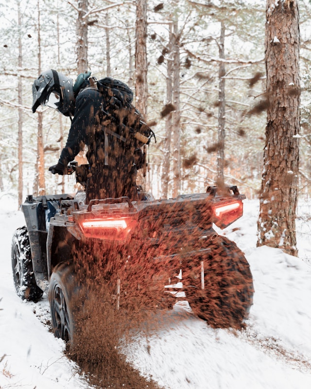
Maine has two main electric utilities, and which one serves a parcel depends on location: Central Maine Power (CMP) serves central, southern, and western Maine, while Versant Power serves eastern and northern Maine, including most of Aroostook County and the Bangor region. Before you fall for a parcel, check the serving utility’s coverage and request an estimate for any line extension. Many buyers who can’t justify the extension cost choose a hybrid approach — solar with a generator backup — but if grid power is a firm requirement, prioritize parcels where the drop is genuinely at or very near the building site.
The Best Regions for Trail Land With Power
Based on where Maine’s ITS network and utility service actually overlap near towns, these are the regions where trail-accessible land with power is most realistically found:
Aroostook County (The County) — Maine’s northern frontier and arguably the heart of its snowmobiling economy. The ITS corridors (including ITS 81, 83, 85 and 88) thread through the region, and the towns — Presque Isle, Caribou, Fort Kent, Ashland, Portage, Houlton, and the Long Lake / Mattawamkeag Lake areas — offer parcels where trail access and Versant power coincide. Land here is also among the most affordable in the state, and many parcels are enrolled in Maine’s Tree Growth tax program, keeping property taxes low.
Jackman / Moose River Region — Right on the Quebec border and a major ITS hub (a 24/7 international crossing), Jackman is snowmobiling country through and through, with trail-side land near the town where power is available.
Greenville / Moosehead Lake — The gateway to the North Woods, with a strong trail network around the largest lake in the state and a real town (Greenville) providing services and power near the trail corridors.
Rangeley / Eustis / Stratton — Western Maine’s mountain-and-lake snowmobiling region, with ITS access and CMP power near the villages, plus the draw of skiing and summer recreation that makes a four-season camp more appealing.
Katahdin / Millinocket area — Trail country near Baxter State Park and Katahdin Woods and Waters, with parcels near town where power reaches, though many lots in this region are genuinely remote and off-grid.
What to Verify Before You Buy
Trail-accessible recreational land rewards due diligence. Before you commit, confirm each of these:
- Trail access is real and current. Cross-check the parcel against the official MSA Interconnected Trail System map, and contact the local snowmobile club for the area (the MSA can provide the club contact) to confirm the trail actually runs where the listing claims and isn’t slated for a reroute.
- Power availability and cost. Identify the serving utility (CMP or Versant), confirm exactly where the nearest line is, and get a written estimate for extending service to your intended building site — not just “to the road.”
- Legal access to the lot itself. Confirm you have deeded road frontage or a recorded right-of-way (ROW) to reach the parcel year-round, separate from the snowmobile trail. A snowmobile trail is not a legal driveway.
- Tree Growth tax status. Many recreational parcels are enrolled in Maine’s Tree Growth Tax Law, which lowers taxes but carries obligations and potential penalties for withdrawal. Understand the enrollment before you buy.
- A soil test (“perc test”) if you intend to build a camp with a septic system, and confirm there are no deed restrictions preventing the use you have in mind.
- Whether the trail is ITS or club-only, and whether ATVs are allowed. ITS trails are not always open to ATV use, which matters if you want year-round trail riding, not just winter.
What Trail Land Costs
Prices vary widely with acreage, access, and location, but recreational parcels with trail access in northern and western Maine commonly run from around $30,000 for a small buildable lot to $120,000 or more for larger acreage or parcels with water frontage, power already at the site, or a existing camp. Aroostook County tends to offer the most land for the money; the western mountains and lakefront parcels command a premium. On-grid parcels with power already at the building site consistently cost more than comparable off-grid land — the market prices in exactly the convenience this guide is about.
Frequently Asked Questions
Can you really snowmobile directly from your own property in Maine?
Yes, if the property connects to a marked, permission-granted trail — but this depends on landowner permission maintained by the local snowmobile club, not a permanent easement. Confirm current trail access with the local club before buying, and remember that riding off the marked trail across other private land requires the landowner’s permission.
Does “power at the road” mean the land has electricity?
Not exactly. It means a utility line reaches the road frontage. Bringing power from the road to a building site set back in the woods can cost thousands to tens of thousands of dollars depending on distance and terrain. Always get a line-extension estimate from the serving utility (CMP or Versant) before assuming a parcel is “on the grid.”
Where in Maine is the best recreational land on snowmobile trails?
Aroostook County offers the most trail-accessible land and the best value; the Jackman/Moose River region, Greenville/Moosehead, and the Rangeley/Eustis area are also prime snowmobiling country where trail access and power can be found near towns. The specific sweet spots are parcels where the ITS network passes close to a town or an existing powered road.
What is the ITS in Maine?
The ITS, or Interconnected Trail System, is the network of roughly 3,500 miles of primary snowmobile “highway” trails that connect across Maine (part of a ~14,000-mile total system). ITS trails are marked in red on the official Maine Snowmobile Association map and let riders travel long distances across the state and into Canada.
Planning a move to Maine as well as a camp? See our Moving to Maine guide and our guides to living in Bangor and other Maine cities. MaineGuide.com has been Maine’s resource guide since 1995.
Planning to hunt in Maine? See our Maine Hunting License Guide — 2026 fees, deer/bear/turkey/moose permits, hunter education, and where to buy.
Riding an ATV in Maine? See our Maine ATV Trails & Registration Guide — 2026 fees, where to ride, trail maps, and the rules every rider needs.