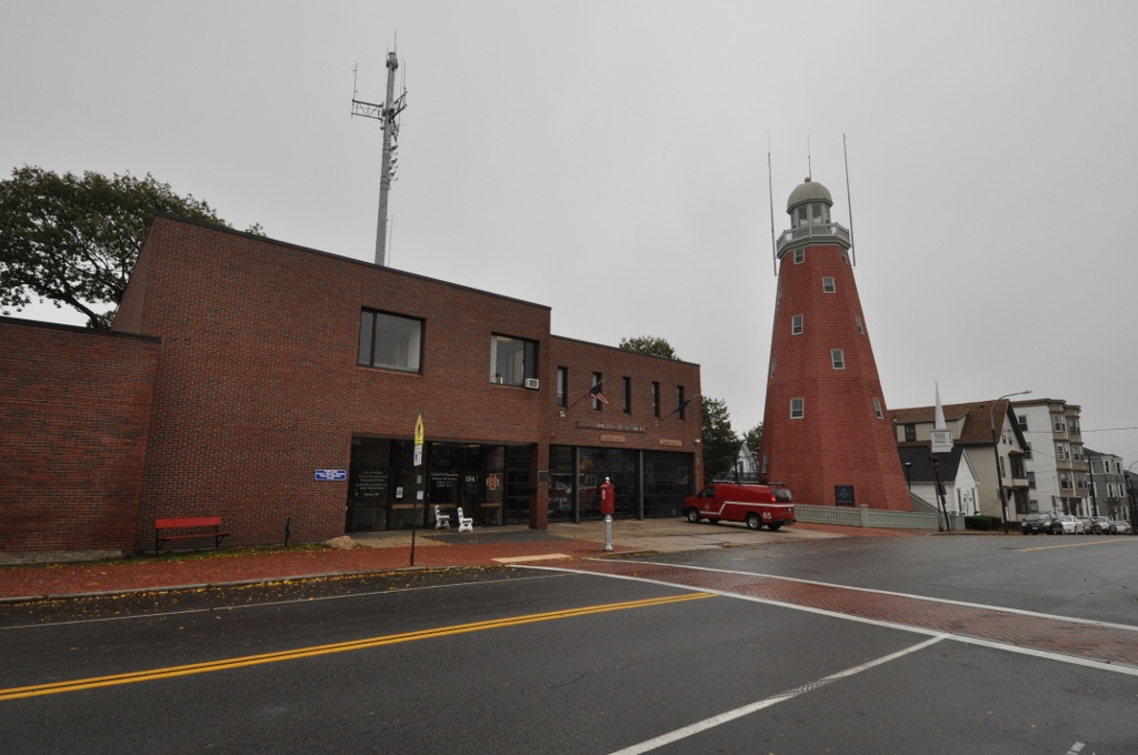
Munjoy Hill is the neighborhood on the hill at the northeastern end of Portland’s peninsula, east of downtown, with views over the harbor and Casco Bay. Here is where it is, where the name comes from, who lived there, what to see on and around the hill, and how the neighborhood has changed.
Munjoy Hill at a glance
- Where: the northeastern end of the Portland peninsula, east of downtown and south of East Deering, according to Wikipedia. It overlooks the harbor to the south, Casco Bay and its islands to the east and north, and Back Cove to the west.
- Height: the hill rises to 161 feet.
- The name: Wikipedia says it comes from George Munjoy (about 1626 to 1680), who moved north from the Massachusetts Bay Colony in 1659. For a time in the early 19th century it was called “Mount Joy.”
- Main street: Congress Street, downtown’s main artery, ends at the Eastern Promenade.
- On the crest: the Portland Observatory and the neighborhood fire station, between Kellogg and St. Lawrence streets.
- Historic district: the city of Portland keeps a page on the Munjoy Hill Historic District that describes the architectural styles of the Hill’s houses.
Who lived on Munjoy Hill
Wikipedia says the neighborhood had a large Irish and Italian American population in the 19th and 20th centuries. The house-by-house histories in Greater Portland Landmarks’ Munjoy Hill Stories show a wider mix. Many residents were immigrants or first-generation Americans. The stories include a Russian Jewish grocer who built apartments at 74-76 Munjoy Street in 1916 and a Jamaican-born family that bought 48 Lafayette Street in 1927. Some houses went up soon after the Great Fire of 1866, such as 63-69 St. Lawrence Street, built about 1868. Landmarks also traces the shift from single-family homes to multi-unit buildings as the population grew.
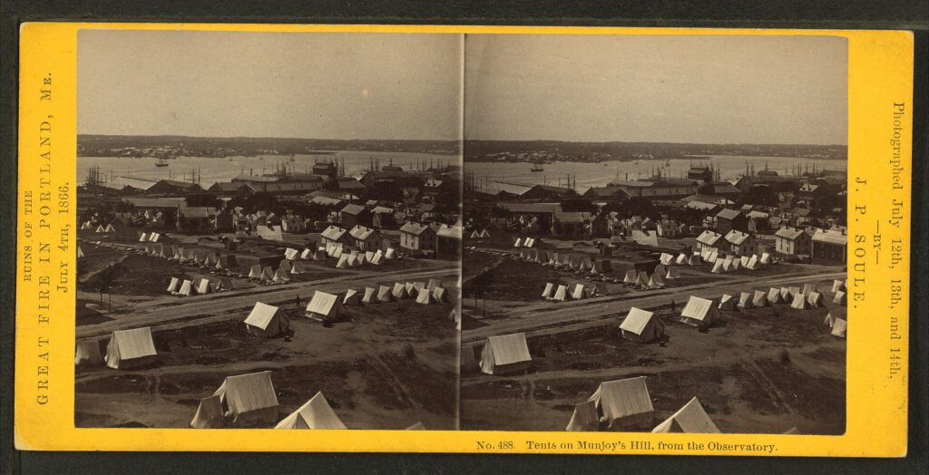
Kate Burch of Greater Portland Landmarks, writing on Atlantic Black Box in 2020, says Lafayette Street on Munjoy Hill was one of three peninsula neighborhoods historically home to Portland’s Black residents. From the mid-1800s many lived on Lafayette and Merrill streets. Some were born in Maine, and others came from Canada (especially Nova Scotia), the Caribbean, Portugal, Cape Verde and several U.S. states. According to the article, the men worked as seamen, waiters, cooks, janitors and laborers, and the women as laundresses, seamstresses and housekeepers. One example is William J. Jones, born in the Danish West Indies, who bought land on Lafayette Street in 1850. The article notes that the Abyssinian Meeting House is in the Newbury Street area, not on Munjoy Hill.
The Hill also had industry. Wikipedia says the Eagle Sugar Refinery operated on Fore Street at the foot of Mountfort Street until 1891.
What to see on Munjoy Hill
Portland Observatory
According to Greater Portland Landmarks, Captain Lemuel Moody (1768 to 1846) ordered the octagonal tower built in 1807. It stands 86 feet tall and served as a commercial signal tower for the harbor. Moody used a powerful telescope to spot ships up to 30 miles away and hoisted flags to tell subscribing merchants which vessels were arriving. It stopped working as a marine signal station in 1923, when two-way radio made it obsolete, and it opened to tourists in 1939 after the city received it and restored it. It became a National Historic Landmark in 2006. The city owns the tower, and Greater Portland Landmarks operates it as an educational site. Hours, prices and tour times change, so check the Landmarks page before you go.
Eastern Promenade
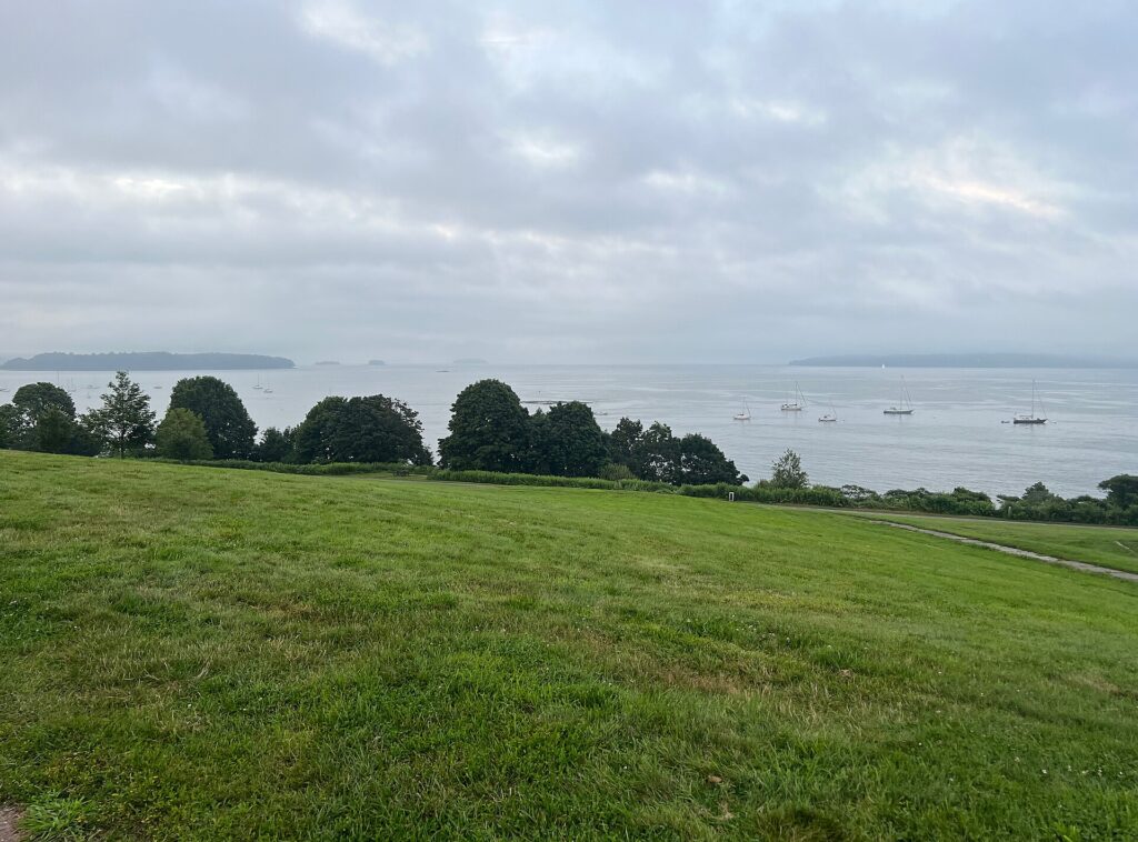
This waterfront park rings the Hill and looks over the harbor, Casco Bay and the islands. Wikipedia’s Eastern Promenade article says it was designed by the Olmsted Brothers, that construction began in 1836 and continued periodically until 1934, and that it was added to the National Register of Historic Places on October 16, 1989. It gives the size as 68.2 acres. The park has a paved trail of 2.1 miles, baseball fields, basketball courts and tennis courts. Wikipedia’s Munjoy Hill article adds that the Eastern Promenade Trail connects with the Back Cove Trail, and that the Maine Narrow Gauge Railroad runs tourist trains along the Casco Bay shore. For trail length, parking, the beach and dogs, see our Eastern Promenade guide.
Fort Allen Park
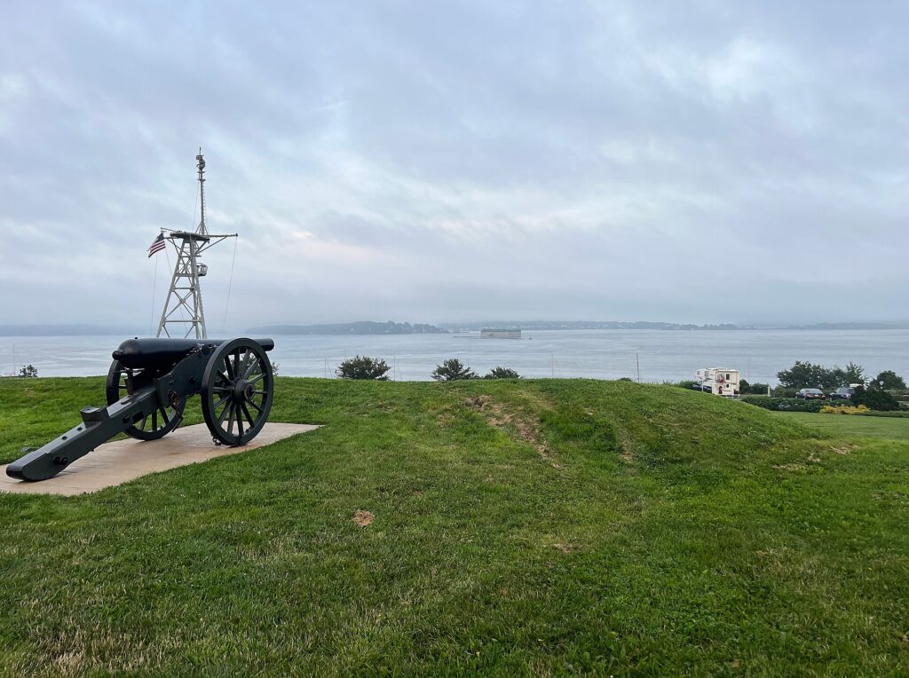
Fort Allen Park sits at the end of the Eastern Promenade, with a full view of Portland Harbor. According to Wikipedia, it is the site of Fort Allen, which was active in the Revolutionary War and the War of 1812, and only a few earthworks remain. The park also has a Civil War granite bench monument dedicated in 1929 to the Union Army and the mast of the heavy cruiser USS Portland, which was commissioned in 1933.
Eastern Cemetery
Greater Portland Landmarks says Eastern Cemetery was established in 1668 and is Portland’s oldest public burial ground. The captains of the Boxer and the Enterprise, who died in a sea battle during the War of 1812, are buried there, along with Lemuel Moody, who built the Observatory. The city owns the cemetery. The volunteer nonprofit Spirits Alive!, founded in 2006, handles much of its preservation and runs seasonal tours.
East End Beach
Wikipedia describes it as a small public beach on the eastern side of the hill that is popular with kayakers and families. It says dog owners and their pets also use it after 5 p.m.
Munjoy Hill today
A 2024 Bowdoin College honors thesis by Katharine Kurtz, “East End Eden”, covers the Hill from 1990 to 2024. It says the neighborhood was an industrial hub in the late 1800s and early 1900s, deindustrialized in the 1990s, and is now described as Portland’s most desirable neighborhood, with high-end condos, water views, restaurants and breweries. The thesis addresses a dramatic increase in housing prices and three ways residents responded: affordable housing development, zoning and historic designation. It gives no price figures in the summary we read.
For what it costs to live here, how it compares with the West End, East Bayside and Back Cove, and the trade-offs, see our guide to living in Portland, Maine.
Why the sources disagree
- The Observatory’s date. Greater Portland Landmarks says construction was ordered in 1807 on its tower history page, and says Moody built it in 1807 on its Munjoy Hill Stories page. We use 1807 as the year it was started and do not give a completion date.
- The size of the Eastern Promenade. Wikipedia’s text gives 68.2 acres, while its infobox lists 32.3 acres. The infobox figure is probably the National Register district, but the article does not explain the difference.
- Where the Hill ends. Wikipedia says Washington Avenue across Back Cove is considered the neighborhood’s boundary, and that the Fox Street and India Street areas merge into downtown and Bayside. We found no official boundary.
Munjoy Hill, Portland: FAQ
Where is Munjoy Hill in Portland, Maine?
At the northeastern end of the Portland peninsula, east of downtown and south of East Deering. Congress Street ends at the Eastern Promenade on the Hill.
Why is it called Munjoy Hill?
Wikipedia says it is named for George Munjoy (about 1626 to 1680), who settled near the intersection of Mountfort and Fore streets. For a time in the early 19th century it was called “Mount Joy.”
What is there to see on Munjoy Hill?
The Portland Observatory, the Eastern Promenade, Fort Allen Park, East End Beach and Eastern Cemetery, Portland’s oldest public burial ground.
Can you go up the Portland Observatory?
It has been open to tourists since 1939 and is operated by Greater Portland Landmarks. Check the Landmarks website for current hours, prices and tour times.
How old is Eastern Cemetery?
Greater Portland Landmarks says it was established in 1668.
Is Munjoy Hill a good place to live?
It is one of Portland’s most sought-after neighborhoods, and our living guide describes it as one of the city’s most expensive. See our living in Portland guide for prices, the other neighborhoods and the trade-offs.
Our details come from Wikipedia’s Munjoy Hill and Eastern Promenade articles, Greater Portland Landmarks (Portland Observatory, Eastern Cemetery and Munjoy Hill Stories), Atlantic Black Box, a Bowdoin College honors thesis and the City of Portland. Hours, tour times and prices change, so confirm before you go.