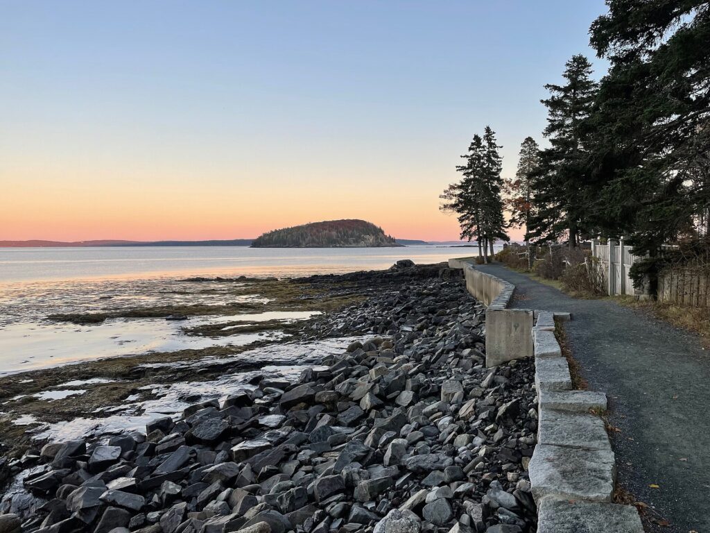
The Shore Path is a level gravel walk along Frenchman Bay in Bar Harbor, Maine, that starts beside Agamont Park and runs south past old inns and summer cottages to Wayman Lane. It is free and open all year. Sources give its length as anything from half a mile to a full mile and name different starting points, so here is what each one says, along with parking, the rules and where the sources disagree.
The Shore Path at a glance
- What it is: a coastal walking path along Frenchman Bay in downtown Bar Harbor, maintained by the Bar Harbor Village Improvement Association on behalf of the landowners along it and the town’s residents, according to the Town of Bar Harbor.
- Route: from Ells Pier beside Agamont Park, along the shore to Wayman Lane, per Wikipedia and the town.
- Length: about 0.7 to 0.75 mile by the most specific figures, though sources range from half a mile to nearly a mile. See below.
- Surface: gravel, per Wikipedia and the Village Improvement Association. The town calls it a level walking path.
- Cost and hours: no fee, and Wikipedia lists it as open all year.
- Age: about 1880, though Wikipedia says 1881.
How long is the Shore Path?
It depends on the source:
- 0.70 mile: Maine Trail Finder, which lists the Town of Bar Harbor as the trail manager.
- 0.75 mile (1.2 km): the Wikipedia infobox. Its text gives no total length.
- “1/2 to 3/4 of a mile”: Acadia Magic in its article, though the page’s summary says half a mile.
- “Just under one mile”: the Village Improvement Association.
- “Nearly mile-long”: U.S. News.
- 1.5 miles: a social media post describes the path as a 1.5 mile round trip, which would be about 0.75 mile each way.
The town’s page does not give a length. The measured figures cluster around 0.7 to 0.75 mile one way, so expect to walk roughly a mile and a half if you return the same way.
Where does the Shore Path start and end?
The north end is described three ways, and the south end is consistent:
- Ells Pier beside Agamont Park: the town and Wikipedia.
- The Town Pier next to Agamont Park: Acadia Magic and Maine Trail Finder, which describe the path running east past the Bar Harbor Inn, rounding a point and turning south along the eastern shore.
- The Bar Harbor Inn or Ells Pier: an essay on Substack puts the start at either.
- The south end: Wayman Lane, in every source.
These are all the same short stretch of waterfront. Wikipedia says exits lead to Main Street, about 0.3 mile away at most, via Albert Meadow and Hancock Street. Maine Trail Finder says a connecting path at the far end runs via Wayman Lane to Main Street so you can loop back through town. The Village Improvement Association says there are two access points along the way.
Parking and getting there
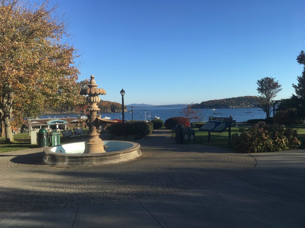
Acadia Magic says to use the public pier or the lot on the south side of Agamont Park, and that if West Street is blocked by cruise passenger traffic you can turn left from Main Street to reach the park’s south side. Maine Trail Finder says to park in downtown Bar Harbor and walk to the Town Pier, and that waterfront parking can fill up in summer. The town’s page does not cover parking. For questions about the path, Maine Trail Finder lists the Town of Bar Harbor as the trail manager, at 207-288-4098. If you are visiting without a car, see our guide to getting to Bar Harbor without a car.
What you will see
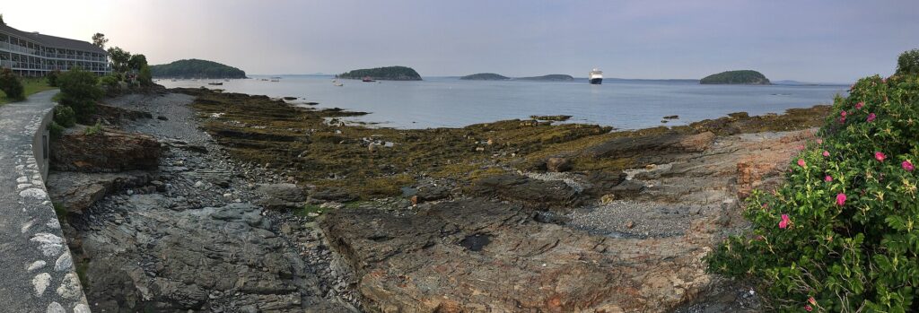
- The water: Frenchman Bay and the Porcupine Islands. The town also names Balance Rock, Egg Rock Light and the Schoodic Peninsula. Acadia Magic adds Bar Island, which it says can be reached at low tide by a natural land bridge.
- Balance Rock: a boulder deposited by an ice age that sits on the shore beside the path, per Wikipedia.
- Inns and cottages: the town says the path passes one of Bar Harbor’s oldest inns and several historic summer cottages. Wikipedia names the Bar Harbor Inn, the Balance Rock Inn, Uncle Steve’s Point, Grant Park and the Tudor Revival John Innes Kane Cottage, built in 1904.
- Plants and details: beach roses in summer, old fences and stone retaining walls, per Maine Trail Finder and the Village Improvement Association.
- Information panels and benches: the Association says stone benches were added in 2012 and historic information panels in 2013.
Surface, rules and dogs
- Surface: gravel, per Wikipedia and the Association. Maine Trail Finder says gravel or crushed stone with some pavement. Acadia Magic mentions wet rocks and granite ledges and a newly installed metal railing on the repaired section, so wear shoes with grip and be careful on algae-covered rock.
- Width: the Association says the section between Agamont Park and Grant Park was widened from three feet to six feet.
- Bikes: Wikipedia says cycling is not permitted.
- Dogs: Maine Trail Finder says pets are permitted. The town’s and the Association’s pages do not address dogs, so confirm with the town before you bring one.
- Private property: the Association says landowners allowed public access across their properties, and asks visitors to respect their privacy.
Storm damage and repairs
Wikipedia says the Village Improvement Association spent about $150,000 between 2012 and 2016 on roughly 1,200 feet of path, resurfacing it and rebuilding seawalls. A January 2024 storm then caused extensive damage, and Wikipedia says the path stayed closed into summer. Acadia Magic says the damage was repaired by June 2025. The sources do not say exactly when the full path reopened, so ask the town about current conditions, especially after winter storms.
History of the Shore Path
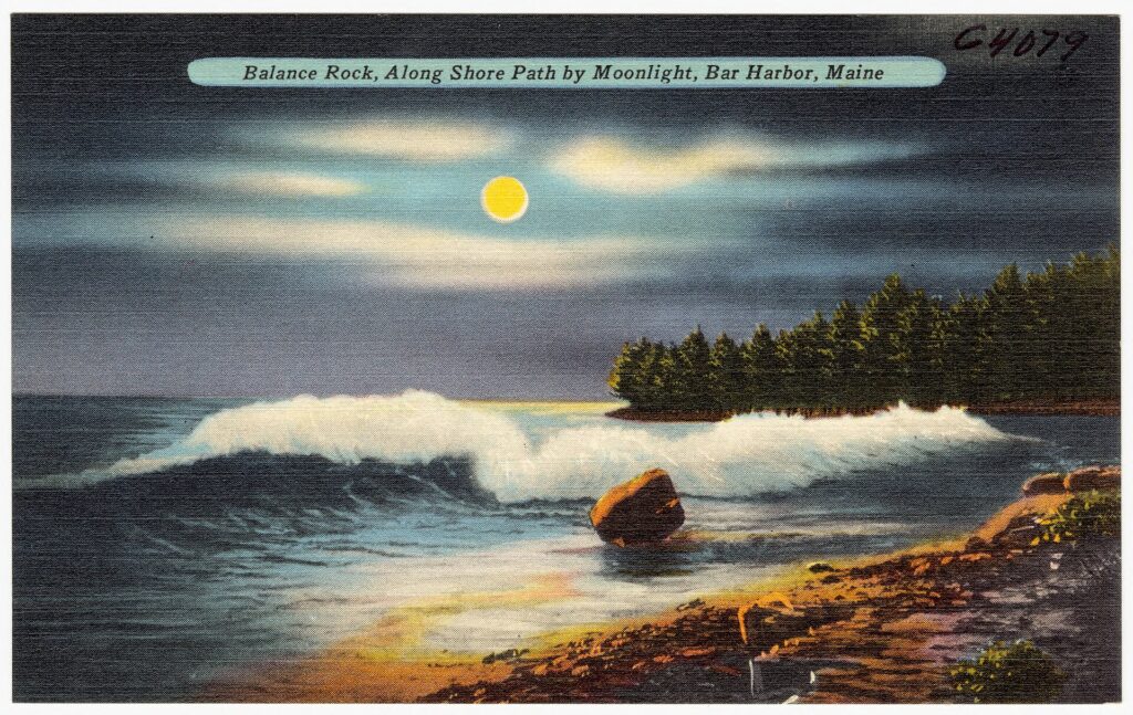
The Village Improvement Association and Acadia Magic date the path to about 1880, U.S. News says 1880 and Wikipedia says 1881. The town says only that it is more than a century old. The Association says local landowners allowed public access across their properties and that it maintains the path and seawall. It also says a postcard printing error once labeled it “The Shaw Path.” Wikipedia says the Association pledged $30,000 for the path in front of Grant Park, completed with the park’s 2017 redevelopment.
Why the sources disagree
- Length. The figures run from half a mile to nearly a mile, with the most specific ones at 0.7 to 0.75 mile. One source counts a round trip.
- The start. Ells Pier, the Town Pier, or the Bar Harbor Inn. All sit within a short walk of each other beside Agamont Park.
- The year. 1880 in most sources and 1881 in Wikipedia.
- When it reopened. Wikipedia says the path stayed closed into summer 2024 after the January storm. Acadia Magic says repairs were finished by June 2025. We could not find a single reopening date.
- Dogs. One source says pets are permitted and the official pages are silent.
Shore Path: FAQ
How long is the Shore Path in Bar Harbor?
The most specific figures are 0.7 mile (Maine Trail Finder) and 0.75 mile (Wikipedia), one way. Other sources say anywhere from half a mile to nearly a mile.
Where does the Shore Path start?
At Ells Pier, also called the Town Pier, beside Agamont Park, according to the town and Wikipedia. It ends at Wayman Lane.
Is the Shore Path free?
Yes. Maine Trail Finder lists no fee, and Wikipedia lists the path as open all year.
Is the Shore Path paved?
No. Wikipedia and the Village Improvement Association say gravel. Maine Trail Finder says gravel or crushed stone with some pavement.
Are dogs allowed on the Shore Path?
Maine Trail Finder says pets are permitted. The town does not address dogs on its page, so confirm before you go.
Can you bike the Shore Path?
No. Wikipedia says cycling is not permitted.
Where do you park for the Shore Path?
Acadia Magic says to use the public pier or the lot on the south side of Agamont Park. Waterfront parking can fill in summer, per Maine Trail Finder.
Is the Shore Path open after the 2024 storm?
Wikipedia says the January 2024 storm damaged it extensively and it stayed closed into summer. Acadia Magic says repairs were done by June 2025. Check with the Town of Bar Harbor for current conditions.
How old is the Shore Path?
About 1880 per most sources and 1881 per Wikipedia.
Our details come from the Town of Bar Harbor, Wikipedia, the Bar Harbor Village Improvement Association, Acadia Magic, Maine Trail Finder and U.S. News. Conditions, parking and rules change, so confirm before you go.
Keep Reading
MaineGuide.com has been helping people visit, move to and work in Maine since 1995. We are part of a Maine network that includes JobsInMaine.com, connecting Maine employers and job seekers since 1997.