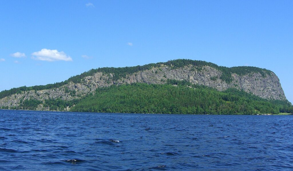
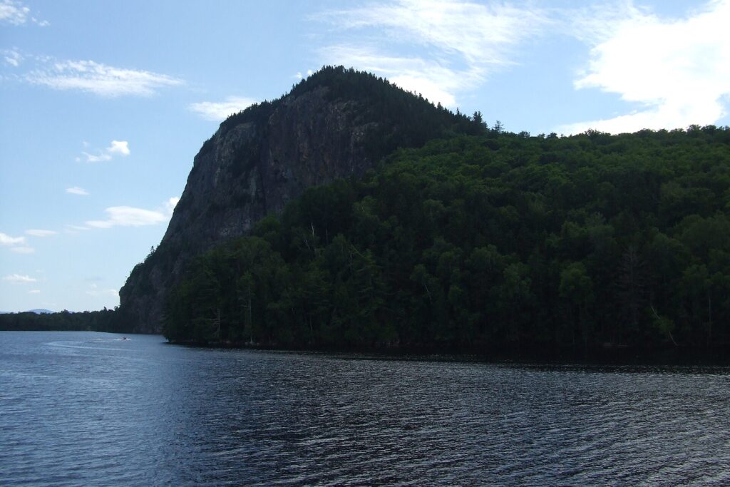
Mount Kineo is a 1,789-foot mountain with a sheer cliff face on a peninsula in Moosehead Lake, near Rockwood. There is no road to it. You reach it by the Kineo shuttle boat, a crossing of about 10 minutes from the Rockwood public landing. The 2026 shuttle season ended October 12 and the operator says service resumes in May 2027. In winter, some hikers walk across the ice. Four trails climb to a summit fire tower with views over the lake.
Mount Kineo at a Glance
- Where: a peninsula on the east shore of Moosehead Lake, across the water from Rockwood. Wikipedia gives the peninsula as about 1,150 acres, with the state park covering about 800 of them.
- Getting there: by boat only. The shuttle leaves the Rockwood public landing, 62 Village Road, and the crossing takes about 10 minutes.
- Shuttle fares (2026): $15 round trip, $8 one way, free for children under 9. Bicycles are $5.
- Summit: 1,789 feet above sea level, per the Bangor Daily News.
- Cliffs: sources say 700 feet (Maine Trail Finder, Wikipedia) or 800 feet (Visit Maine).
- Trails: four trails, about 6.1 miles in total. The shortest summit route is 0.9 miles.
- Time: the shuttle operator says 2 to 2.5 hours from the dock to the tower and back. Allow about 4 hours or more for a longer loop.
- Dogs: allowed, per Maine Trail Finder. Keep them leashed.
Is the Mount Kineo Shuttle Running Now?
No. The shuttle operator’s 2026 season ran from May 22 to October 12, and its site says service resumes in May 2027. We could not find a winter boat service. If you are reading this outside the season, the only way onto the peninsula is your own boat or, when the ice is safe, on foot across the lake (see the winter section below).
How to Get to Mount Kineo
Drive to Rockwood. Maine Trail Finder puts it about 15 miles northwest of Greenville on Routes 15 and 6. Visit Maine describes Kineo as about 20 miles west of Greenville, so the numbers differ by source, but the route is the same. The shuttle leaves from the Rockwood public landing at 62 Village Road. Park there and cross by boat.
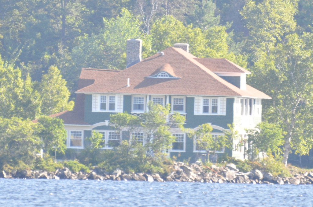
The shuttle is run by the Mt. Kineo Golf Course and Shuttle, (207) 534-9012. Check the operator’s site for the current season before you go.
Shuttle Schedule and Fares
These are the operator’s 2026 times. Dates and prices can change each year, so confirm the 2027 schedule before you plan around it.
- May and June: boats leave Rockwood at 9, 11, 1 and 3, with returns at 10:45, 12:45, 2:45 and 4:45.
- July and August: hourly from 8 a.m. to 6 p.m., with the last return at 6:45 p.m.
- September and October, weekdays: leaving Rockwood at 9, 11, 1 and 3, with returns at 8:45, 10:45, 12:45, 2:45 and 4:45.
- September and October, weekends: hourly from 8 a.m., with the last shuttle at 4:00 p.m.
- Fares: $15 round trip, $8 one way, children under 9 free, bicycles $5, extra bags $5, golf bags free.
Older sources show other numbers. ActivityMaine listed $13 round trip and cash only, and an earlier version of this page repeated hourly boats from 8 a.m. without saying that applies to July and August. Use the operator’s current schedule.
Do not miss the last boat. There is no other way off the peninsula, and the final return time changes with the month. Golf carts on the island are for golfers only, and the cart paths are not hiking trails.
Winter: Crossing the Ice
The shuttle doesn’t run in winter. The Bangor Daily News describes hikers skiing or walking across the frozen lake from the Rockwood town landing, a walk of just under a mile, with a staked snowmobile trail marking the route. Only cross if the ice is strong enough and the route is marked, and check conditions locally first.
The Trails
From the Kineo docks, a shoreline path (an old carriage road) leads about 0.8 miles to State land, where the trails begin. Maine Trail Finder lists these four:
- Indian Trail (0.9 miles, moderate): the shortest and steepest way to the summit, along open ledge near the cliff tops. It has the best views.
- Bridle Trail (1.1 miles, easy): the original fire warden trail. It is more gradual and wooded, and joins the Indian Trail just below the summit.
- Carriage Trail (2.2 miles, easy): a walk along the west shore to Hardscrabble Point. It doesn’t climb the summit.
- North Trail (1.9 miles, moderate): climbs the southeastern cliffs and links to the Carriage Trail. It is the longest route to the top, and visitors report fading markers and muddy sections.
Bring a map or photograph the trail board at the docks.
The Summit and Fire Tower
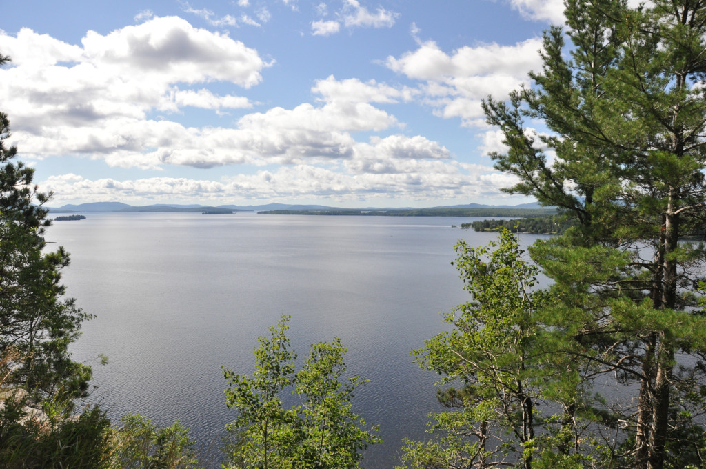
All the summit trails end at the old fire tower, which the Maine Forest Service used until around 1960. According to the Bangor Daily News, it is steel with a wood deck and stands 64 feet tall. The view takes in Moosehead Lake, the surrounding mountains and the golf course below. Check the condition of the tower and use the railings carefully.
How Long Does the Hike Take?
It depends on the route. The shuttle operator says the dock to the tower and back by the Bridle and Indian trails takes about 2 to 2.5 hours, and 4 to 5 hours if you come down the North Trail. The Bangor Daily News author took about 4 hours for 6.3 miles with roughly 1,000 feet of climbing. AllTrails lists a 3.4-mile loop. Add the boat crossing and wait time to any of these.
Why Mount Kineo Is Famous
According to Wikipedia, the mountain is made of rhyolite, and it describes it as the largest known mass of that rock in the region. Wikipedia also says Henry David Thoreau visited in 1846. Maine Trail Finder says the name comes from a Wabanaki warrior, Kinneho.
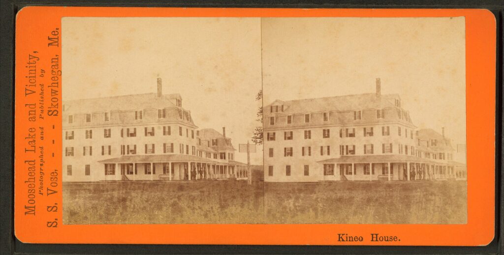
Kineo was once a resort. Wikipedia lists a Kineo House hotel opened in 1848 that burned in 1868, a rebuilt hotel that opened in 1871 and burned in 1882, and a third hotel in 1884. Maine Central Railroad bought the resort in 1911, and Wikipedia calls it the largest inland waterfront hotel in America, with room for over 500 guests. It was sold in 1938 and burned during demolition. The golf course dates to an 1893 layout and is described as the second oldest in New England.
Why the Sources Disagree
We found real conflicts, so here they are rather than a single confident number.
- Cliff height: Visit Maine says 800 feet. Maine Trail Finder and Wikipedia say about 700. We found no survey to settle it.
- Acreage: 1,150 acres is the whole peninsula per Wikipedia, and about 800 acres is the state park. Pages that give one number often mean different things.
- Island or peninsula: Wikipedia calls it a peninsula. Visitors often call it an island because the only access is by water.
- Trail name: Visit Maine says “Indian Head Trail.” Maine Trail Finder says “Indian Trail.”
- Hike length: AllTrails lists a 3.4-mile loop, while the shuttle operator gives 2 to 2.5 hours for the shortest route. The routes and starting points differ.
- Fares and schedule: older sources show $13 and different hours. We use the operator’s 2026 numbers.
- Distance from Greenville: about 15 miles to Rockwood (Maine Trail Finder) versus about 20 miles west (Visit Maine).
Safety and Rules
- Cliffs: stay back from the edges, especially when the rock is wet.
- Peregrine falcons nest on the cliffs. Stay out of nesting areas and obey any posted closures.
- Weather on the lake: Moosehead Lake is cold and the wind can rise quickly. If you take your own boat, wear a life jacket and watch the forecast.
- Tell someone your plan, and bring water, food and a map.
- Fees and hours: the Bangor Daily News listed admission from free to $4 depending on age and residency, and hours of 9 a.m. to sunset. That was 2021, so confirm with the Maine Bureau of Parks and Lands.
Camping, Food and Dogs
Dogs are allowed on a leash. The Bangor Daily News mentions primitive campsites at Hardscrabble Point, and Maine Trail Finder’s map shows a tent site, but neither gives rules or reservation details. Contact the Maine Bureau of Parks and Lands at Lily Bay State Park, (207) 695-2700, before planning to camp. ActivityMaine mentions a walk-up lunch window at the golf course clubhouse that depends on the boat schedule. Don’t count on it, and bring your own food.
When to Go
The shuttle runs from late spring into early October. In 2026 the schedule was thinnest in May and June and fullest in July and August, which also bring the most visitors. In September and October the weekday boats return earlier and the weekend last shuttle leaves at 4:00 p.m., so plan your return. Winter is possible only for people prepared for ice and snow.
Nearby Hikes and Waterfalls
Visiting the Moosehead Lake region? See our Moosehead Lake guide and things to do around Moosehead Lake. You may also like Moxie Falls near The Forks and Gulf Hagas, the slate gorge near Brownville. For more trails, see our Maine hiking guide and best hikes in Maine.
Frequently Asked Questions
How do you get to Mount Kineo?
Drive to Rockwood and take the Kineo shuttle boat from the public landing at 62 Village Road. The crossing takes about 10 minutes. There is no road to the peninsula.
Is there a shuttle to Mount Kineo?
Yes, in season. The 2026 season ran May 22 to October 12, and the operator says service resumes in May 2027. Confirm dates and times before you go.
How much does the Mount Kineo shuttle cost?
In 2026 it was $15 round trip and $8 one way, with children under 9 free and bicycles $5.
What time is the last boat back?
It depends on the month. In 2026 the last return was 6:45 p.m. in July and August and 4:45 p.m. in May, June and on September and October weekdays. On September and October weekends the last shuttle left at 4:00 p.m.
How long is the hike up Mount Kineo?
The Indian Trail is the shortest summit route at 0.9 miles, and the Bridle Trail is 1.1 miles. The operator says 2 to 2.5 hours for the dock to the tower and back. A longer loop takes 4 hours or more.
How high is Mount Kineo?
The summit is 1,789 feet above sea level. The cliffs are listed at 700 or 800 feet, depending on the source.
Is Mount Kineo an island?
Wikipedia calls it a peninsula, but you can only reach it by water, so many visitors treat it as an island.
Can you take a dog to Mount Kineo?
Yes, on a leash. Keep dogs out of falcon nesting areas and away from the cliff edges.
Can you camp on Mount Kineo?
Primitive campsites are mentioned at Hardscrabble Point, but we couldn’t find rules or reservation details. Contact the Maine Bureau of Parks and Lands before planning to camp.
Can you visit Mount Kineo in winter?
Some hikers cross the frozen lake from the Rockwood town landing on skis or snowshoes, but only when the ice is thick enough and the route is marked. The shuttle does not run in winter.
Our details come from Maine Trail Finder, the Mt. Kineo shuttle operator, Wikipedia, Visit Maine, the Bangor Daily News, AllTrails and ActivityMaine. They disagree on a few figures, so we give the range. Shuttle dates and prices change every year, so confirm them with the operator.
Keep Reading
- Moosehead Lake: the region guide
- Things to Do at Moosehead Lake: more to see and do
- Moxie Falls: a waterfall hike near The Forks
- Gulf Hagas: the Grand Canyon of Maine
- Best Hikes in Maine: trails across the state