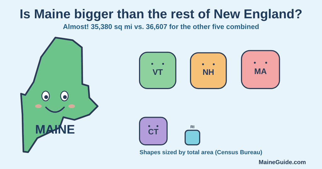
Maine is not quite bigger than the other five New England states combined. By the Census Bureau’s measurements, Maine’s 35,380 square miles is about 97 percent of the 36,607 square miles of New Hampshire, Vermont, Massachusetts, Connecticut and Rhode Island put together. The familiar claim that Maine is “almost as big” as the rest of New England is the accurate version.
The numbers
These are total, land and water areas in square miles from the Census Bureau’s state area measurements, which are based on the 2010 Census:
- Maine: 35,380 total, 30,843 land, 4,537 water.
- New Hampshire: 9,349 total, 8,953 land, 397 water.
- Vermont: 9,616 total, 9,217 land, 400 water.
- Massachusetts: 10,554 total, 7,800 land, 2,754 water.
- Connecticut: 5,543 total, 4,842 land, 701 water.
- Rhode Island: 1,545 total, 1,034 land, 511 water.
Added up, the other five states have 36,607 square miles of total area, which is 1,227 more than Maine. By land alone, they have 31,846 square miles against Maine’s 30,843, a gap of 1,003. Either way, Maine falls short by about 3 percent.
What Maine’s own sources say
The Maine Legislature’s facts page says Maine “is almost as big as all of the other five New England States put together.” It gives a total area of approximately 33,215 square miles, which is lower than the Census figure of 35,380. We did not confirm what accounts for that gap, but the Census total includes 4,537 square miles of water while the legislature’s page lists 2,295 square miles of inland water.
Britannica calls Maine the largest of the six New England states and says its total area, including about 2,300 square miles of inland water, is nearly half of New England’s. Maine’s 35,380 square miles is about 49 percent of the Census total for all six states, which fits.
Aroostook County versus Connecticut and Rhode Island
The Maine Legislature’s page also says Aroostook County, at 6,453 square miles, is larger than Connecticut and Rhode Island combined. By Census land area those two states total 5,876 square miles, which supports the claim. By total area they total 7,088 square miles, which does not. We could not confirm which basis the county figure uses.
Why the sources disagree
- Total area versus land area. Maine has 4,537 square miles of water in the Census totals, and Massachusetts has 2,754, so which number you use changes the margin, though not the answer.
- Different totals for Maine. The Census says 35,380 square miles and the Maine Legislature says approximately 33,215. The sources do not say they count water the same way.
- Round-number claims. Phrases like “almost as big” and “nearly half” are accurate. A flat “bigger than the rest of New England” is not, using the Census figures.
Maine’s size: FAQ
Is Maine bigger than the rest of New England combined?
No, by a small margin. The Census Bureau puts Maine at 35,380 square miles and the other five states at 36,607 combined.
How big is Maine compared to the other New England states?
It is the largest, and by total area about 97 percent of the other five combined. It is roughly 49 percent of all six.
How many square miles is Maine?
The Census Bureau gives 35,380 square miles of total area, 30,843 of land and 4,537 of water. The Maine Legislature’s page says approximately 33,215.
Our details come from the Census Bureau’s state area measurements, the Maine Legislature’s facts page and Britannica. The sums and percentages are our own arithmetic from the Census figures. We have not independently verified these numbers, and the Census figures date to 2010.