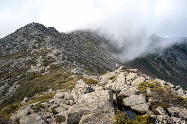
The tallest mountain in Maine is Mount Katahdin, whose Baxter Peak stands about 5,268 feet above sea level. It is the only Maine peak above 5,000 feet. Maine has 14 peaks of 4,000 feet or more, and the next tallest, Katahdin’s Hamlin Peak, is about 4,756 feet.
Baxter State Park says the Baxter Peak summit sign will change from 5,267 to 5,268 feet, based on a University of Maine field measurement of 5,268.8 feet. Other sources list anywhere from 5,266 to 5,270, so the exact figure is not settled.
Tallest mountains in Maine at a glance
- Tallest: Mount Katahdin, Baxter Peak, about 5,268 feet (Piscataquis County).
- Second: Katahdin’s Hamlin Peak, about 4,756 feet.
- Third: Sugarloaf Mountain, about 4,250 feet (Franklin County).
- Peaks of 4,000 feet or more: 14 on the Appalachian Mountain Club’s list.
- Most 4,000-footers by county: Franklin County, with 8.
The 14 tallest mountains in Maine, ranked
Elevations are from the Appalachian Mountain Club (AMC) Four Thousand Footer Committee list, as published by FranklinSites.com, and counties are from Wikipedia’s list of mountains of Maine. Other lists differ by a few feet, as explained below.
- 1. Mount Katahdin, Baxter Peak (Piscataquis): 5,267 feet on the AMC list. Baxter State Park says 5,268.
- 2. Mount Katahdin, Hamlin Peak (Piscataquis): 4,756 feet
- 3. Sugarloaf Mountain (Franklin): 4,250 feet
- 4. Crocker Mountain (Franklin): 4,228 feet
- 5. Old Speck Mountain (Oxford): 4,180 feet
- 6. North Brother (Piscataquis): 4,151 feet
- 7. Bigelow Mountain, West Peak (Somerset): 4,145 feet
- 8. Saddleback Mountain (Franklin): 4,116 feet
- 9. Bigelow Mountain, Avery Peak (Somerset): 4,090 feet
- 10. Mount Abraham (Franklin): 4,050 feet (tied with South Crocker)
- 11. South Crocker Mountain (Franklin): 4,050 feet
- 12. Saddleback Mountain, The Horn (Franklin): 4,041 feet
- 13. Mount Redington (Franklin): 4,010 feet (tied with Spaulding)
- 14. Spaulding Mountain (Franklin): 4,010 feet
Why sources disagree on how tall Maine’s mountains are
Every site we checked lists slightly different elevations, and no source we found explains each difference. These are the clearest examples:
- Katahdin, Baxter Peak: 5,267 feet (AMC list), 5,269 feet (Wikipedia), and 5,267 to 5,270 feet across other sites. Baxter State Park says its sign will change from 5,267 to 5,268 feet after a University of Maine measurement of 5,268.8, and notes NOAA markers show 5,266 and 5,270 while LiDAR-derived maps show 5,267. We have not confirmed that the new sign is up.
- Old Speck: 4,180 feet (AMC list) and 4,170 feet (Wikipedia). Our Grafton Notch guide uses about 4,170.
- Sugarloaf: 4,250 feet (AMC list), 4,249 feet (Wikipedia) and 4,240 feet (the Maine Lakes and Mountains region site).
- Saddleback: 4,116 feet (AMC list) and 4,121 feet (Wikipedia).
The ranking order is the same on the lists we compared, apart from near-ties such as Mount Abraham and South Crocker. If an exact elevation matters, check the summit sign or the U.S. Geological Survey map for that peak.
How many 4,000-footers does Maine have?
Fourteen, on the AMC list as published by FranklinSites.com and on Wikipedia’s table. A tourism page for Maine’s Lakes and Mountains region says ten, because it covers only its own region and leaves out Katahdin’s two peaks, North Brother and Mount Redington. According to the AMC’s FAQ, a peak must rise 200 feet above any ridge connecting it to a higher neighbor, and a 1998 revision added Redington and Spaulding in Maine.
Maine’s tallest mountains by county
- Franklin County: 8 (Sugarloaf, Crocker, Saddleback, Mount Abraham, South Crocker, The Horn, Redington and Spaulding)
- Piscataquis County: 3 (Baxter Peak, Hamlin Peak and North Brother)
- Somerset County: 2 (Bigelow’s West Peak and Avery Peak)
- Oxford County: 1 (Old Speck)
Katahdin sits in Baxter State Park, which is run separately from Maine’s state park system, with its own rules, reservations and limited parking. See our Baxter State Park and Katahdin guide before you plan a climb. For more trails, see our best hikes in Maine. Our state parks guide covers Baxter and other parks.
Tallest mountains in Maine FAQ
What is the tallest mountain in Maine?
Mount Katahdin, at its Baxter Peak, about 5,268 feet. It is the northern end of the Appalachian Trail and sits inside Baxter State Park.
How tall is Mount Katahdin?
About 5,268 feet. Baxter State Park says its sign will change from 5,267 to 5,268 feet after a University of Maine measurement of 5,268.8 feet, while other sources list 5,266 to 5,270.
What is the second tallest mountain in Maine?
Katahdin’s Hamlin Peak, at about 4,756 feet. The tallest mountain outside Baxter State Park is Sugarloaf, at about 4,250 feet.
Is Katahdin the tallest mountain in New England?
No. Mount Washington in New Hampshire is taller. Katahdin is the tallest mountain in Maine.
How many mountains in Maine are over 4,000 feet?
Fourteen peaks, according to the AMC list. Only Katahdin’s Baxter Peak is over 5,000 feet.
Our details come from the FranklinSites.com Maine 4,000-footer list, which credits the AMC Four Thousand Footer Committee, Wikipedia’s list of mountains of Maine, Baxter State Park, the AMC 4000-Footer Club FAQ and Maine’s Lakes and Mountains, checked November 9, 2026. Elevations differ by a few feet between sources, and we have not checked them against the original survey data, so confirm any figure you need for a record or a climb.