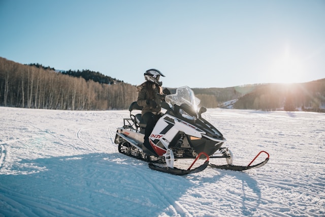
Maine has one of the finest snowmobile trail systems in North America — over 14,000 miles of groomed trails maintained by local snowmobile clubs through the Maine Snowmobile Association. The Interconnected Trail System (ITS) links every corner of the state, from the Canadian border in Aroostook County to the western mountains, making multi-day trips across Maine one of the great snowmobiling adventures available anywhere in the world. After thirty years covering Maine travel, we consider Maine snowmobiling the state’s most underrated winter asset — enormous in scale, well-maintained, and genuinely world-class by any standard.
Staying in town? See our Bingham, Maine guide.
Quick answer: Maine’s best snowmobiling destinations are Jackman (gateway to Canada, dense ITS network, classic snowmobile town), The Forks and Bingham (Kennebec River corridor, Dead River access, central Maine hub), Greenville and Moosehead Lake (remote wilderness riding, ITS 86/87, largest lake in the East as backdrop), and Rangeley (western Maine mountains, interconnected with New Hampshire trails). Season runs December through March most years; peak conditions January-February.
The ITS Corridor System
The ITS (Interconnected Trail System) is Maine’s highway network for snowmobiles — numbered corridors maintained by local clubs that connect communities, fuel stops, lodging, and restaurants throughout the state. Over 14,000 miles of marked and groomed trails form one of the largest snowmobile networks on the planet. Major ITS corridors include:
ITS 84 — the primary Aroostook County corridor, running north-south through The County with connections to New Brunswick, Canada. World-class distance riding through some of the most remote terrain in the eastern US.
ITS 86 and 87 — the Moosehead Lake region corridors, connecting Greenville to the broader system. These routes skirt the shores of Moosehead Lake and penetrate deep into the North Woods wilderness north of the lake.
ITS 89 — the western Maine mountains corridor connecting Rangeley, Stratton, and Jackman. One of the most scenic ITS routes in the state, with significant elevation change through the western highlands.
ITS 85 — the Kennebec Valley corridor running through Bingham and The Forks. Central Maine’s primary snowmobile artery, connecting the coast to the interior.
Trail conditions are reported weekly during the season by local clubs at snowmobilemaine.com. Always check conditions before departing — trail quality varies dramatically after rain events, warm spells, or heavy fresh snow.
Jackman — Gateway to the North
Jackman is Maine’s most iconic snowmobile town — a small community in the upper Kennebec Valley with direct ITS access, fuel, lodging, rentals, and the ability to ride into Quebec, Canada without leaving the trail system. The trails around Jackman are among the best-groomed in Maine, maintained with particular care by the Jackman-Moose River Snowmobile Club. Jackman averages 120+ inches of natural snowfall annually, among the highest in Maine.
The Canada connection is Jackman’s signature feature: experienced riders can cross into Quebec via the ITS and access the Quebec trail network, which connects to hundreds of additional miles. A passport is required for the border crossing. For a full guide to snowmobiling in Jackman including specific trails, rentals, lodging, and the Canada crossing logistics, see our Jackman Snowmobiling guide.
The Forks and Bingham — Central Maine’s Snowmobile Hub
The Forks and neighboring Bingham sit on the Kennebec River in central Maine, at the intersection of ITS 85 and several major connector trails. This area is known as much for snowmobiling as for its summer whitewater rafting reputation — the same dramatic river corridor that draws rafters in summer becomes a snowmobile highway in winter. The terrain is varied: river valley riding, forested highland trails, and connections west toward Jackman and north toward Moosehead.
The Forks in particular has a strong infrastructure for snowmobilers — outfitters, fuel, lodging, and guided snowmobile trips available through the same operators who run summer rafting tours. See our The Forks Snowmobiling guide for destination-specific detail.
Greenville and Moosehead Lake — Wilderness Riding
The Moosehead Lake region centered on Greenville offers the most remote snowmobiling experience in Maine. ITS 86 and 87 skirt the shores of Moosehead Lake — the largest lake in the eastern United States — with wilderness riding through unbroken North Woods forest. The scale here is different from anywhere else in New England: you can ride all day and not see a paved road.
Greenville serves as the supply and lodging hub for Moosehead region riding. The town has fuel, basic provisions, and several lodging options including sporting camps that cater specifically to snowmobile visitors. Big Moose Mountain Ski Area (5 miles north) adds a skiing option for mixed-activity trips. See our Greenville Snowmobiling guide for the full picture.
Rangeley — Western Maine Mountains
Rangeley anchors western Maine snowmobiling — ITS 89 runs through the region, connecting to Jackman to the north and to the New Hampshire trail network to the south. The terrain is mountain-influenced: more elevation change than the flat Aroostook County corridors, with dramatic lake and mountain views throughout. The Rangeley Lakes chain adds visual drama to the riding that flat-terrain systems can’t match.
Rangeley has good snowmobile infrastructure including the Saddleback Mountain area trails and connections throughout the western highland. Many riders combine snowmobiling with a ski day at Saddleback Mountain. See our Rangeley Snowmobiling guide for destination detail.
Aroostook County — The Crown of Maine
Aroostook County — The County — is Maine’s snowmobiling crown jewel for distance riders. The combination of reliable snow (110+ inches annually in some areas), vast unbroken forest, and well-maintained ITS corridors makes The County a destination for serious snowmobilers from across the eastern US and Canada. The scale is simply different here: a multi-day trip through Aroostook County can cover 300-400 miles without repeating terrain.
Presque Isle and Fort Kent are the primary service hubs in Aroostook. The Canadian border runs along the northern edge of the county — trail connections into New Brunswick are available at several crossing points. See our Presque Isle visitor guide for the broader Aroostook context.
Maine Snowmobile Trail Maps
The essential planning tool is the Maine Interconnected Trail System (ITS) map, produced by the Maine Snowmobile Association (MSA) and the state Bureau of Parks and Lands. On the map, ITS trails are marked in red and connector trails in green, with junctions labeled by county — for example “AK37” in Aroostook County. The printed ITS map is updated every year to reflect trail changes, with new editions usually available by late October ahead of the season.
For 2026, the MSA has also launched a brand-new interactive trail app (available for both iPhone and Android) that has quickly become the best digital map for riders. It offers an interactive map of the ITS and connector trails, GPS ride tracking with breadcrumbs, offline use with no cell signal required, nearby services (fuel, food, parking), and trail-condition updates. Between the printed MSA atlas, the official interactive ITS map online, and the new app, you have everything needed to plan a route. You can find the official map at the Maine Snowmobile Association website, and printed maps at the MSA office in Augusta, Maine Tourism Association info centers, and many supporting businesses and local clubs.
Serious riders often plan around Maine’s three legendary loop routes — the Moose Loop, the Katahdin Loop, and the Black Fly Loop — all marked on the trail atlas.
Maine ATV Trails
Many of the same regions that make Maine a premier snowmobiling destination also offer outstanding ATV riding in the warmer months, often on an overlapping network of trails maintained by local clubs. Aroostook County, the Jackman and Moose River region, and the Katahdin area all have extensive ATV trail systems. ATV riders should note that the trail networks and the governing organization differ from snowmobiling — Maine has a dedicated ATV trail atlas and ATV clubs — and, as with snowmobile trails, the vast majority of Maine’s ATV trails cross private land by landowner permission, so staying on marked, permitted trails is essential to keeping access open.
Planning Your Maine Snowmobile Trip
When to Go
Maine snowmobile season typically runs December through March, with peak conditions in January and February. Early December can be marginal; late March sees deteriorating conditions as temperatures warm. The Moosehead and Jackman regions tend to hold snow longest. Always check current trail conditions at snowmobilemaine.com before traveling — a warm spell can dramatically change conditions within days.
Registration and Trail Permits
All snowmobiles operated in Maine must be registered with the Maine Bureau of Motor Vehicles. Out-of-state riders can purchase a non-resident Maine snowmobile registration — required to legally ride Maine ITS trails. Registration can be purchased online or at agent locations. The Maine Snowmobile Association also offers a Corridor Pass for riding the designated ITS corridors — check current requirements at snowmobilemaine.com. See our guide to snowmobile registration in Maine.
Rentals
Snowmobile rentals are available in Jackman, The Forks, Greenville, and Rangeley through local outfitters. Most rental operations require a valid driver’s license, credit card deposit, and orientation session. Guided rides are available through most outfitters for first-time visitors — highly recommended for riders unfamiliar with ITS trails. Book rentals well in advance for January and February peak weekends.
Safety
Maine’s snowmobile trails cross active logging roads, frozen water bodies, and remote terrain far from emergency services. Essential safety practices: always ride with a partner, carry a GPS device with offline maps downloaded, file a trip plan with someone not on the ride, carry emergency supplies (hand warmers, fire starter, emergency blanket), and check ice thickness before crossing any frozen lake or river. Cell service is unreliable throughout most of the ITS network.
Maine Snowmobiling FAQ
Where is the best snowmobiling in Maine?
Maine’s best snowmobiling destinations are Jackman (classic snowmobile town, Canada border access), The Forks and Bingham (central Maine ITS hub, Kennebec corridor), Greenville and Moosehead Lake (wilderness riding, ITS 86/87, most remote experience), and Rangeley (western mountains, New Hampshire connections). Aroostook County is the top destination for serious long-distance riders. All are connected by the ITS — multi-destination trips are common and practical.
How many miles of snowmobile trails does Maine have?
Maine has over 14,000 miles of marked and groomed snowmobile trails, maintained by more than 280 local snowmobile clubs affiliated with the Maine Snowmobile Association. This makes Maine one of the largest snowmobile trail networks in North America.
Do you need a license to snowmobile in Maine?
You do not need a special snowmobile license in Maine, but all snowmobiles must be registered. Out-of-state riders must purchase a non-resident Maine snowmobile registration to legally ride ITS trails. A valid driver’s license is required to operate a snowmobile on Maine trails. Children under 14 may not operate a snowmobile on public trails.
What is the best time to snowmobile in Maine?
January and February are peak months for Maine snowmobiling — reliable snow cover statewide, groomed trails at their best, and full outfitter operations running. Late December can be good but early-season conditions are less reliable. March riding is possible, especially in northern Maine, but warming temperatures create variable conditions. Always check snowmobilemaine.com for current trail conditions before traveling.
Can you snowmobile from Maine into Canada?
Yes. The ITS trail network connects to Canadian trail systems at several border crossings. The most popular crossing for snowmobilers is at Jackman, where the ITS connects to Quebec’s trail network. A valid passport is required for the border crossing. Canadian trail registration may also be required for riding in Quebec — check current requirements before the trip.
Plan Your Maine Snowmobile Trip
For destination-specific guides: Jackman Snowmobiling, The Forks Snowmobiling, Greenville and Moosehead Snowmobiling, and Rangeley Snowmobiling. For broader destination context: Jackman destination guide, Greenville destination guide, Rangeley destination guide, Northern Maine regional overview, and Western Maine regional overview. For driving distances to snowmobile destinations from Portland and Boston, see our Maine Driving Distances guide.
Dreaming of a trailside camp? See our guide to buying recreational land on Maine ITS snowmobile trails with power — the best regions, the trail-access and power trade-offs, and what to verify before you buy.
Related: See our Maine in Winter guide for skiing, snowmobiling, ice fishing, winter events, and what is open and closed from December through March.
Need to register your sled first? See our guide to snowmobile registration in Maine.